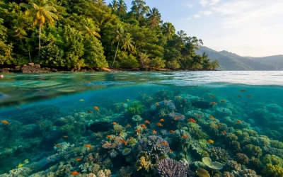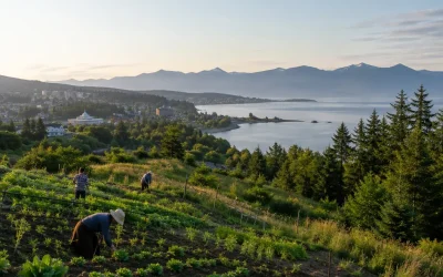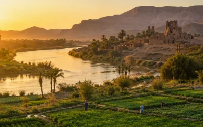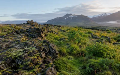
A human geography definition starts with a simple idea: it is the branch of geography that studies the spatial relationships among human communities, cultures, economies, and their environments. It asks why people, activities, and meanings are arranged differently from one place to another, and what those arrangements reveal. A city neighborhood, a migration route, a border, and a farming landscape can all become evidence when the question is not merely what exists, but where it exists, how it got there, and how it changes its surroundings.
Human geography definition: the spatial pattern behind everyday life
Human geography examines the spatial differentiation and organization of human activity and its relationships with the physical environment. “Spatial” is the key word. The field is concerned with patterns across space: the distribution of people, the movement of goods and migrants, the organization of political control, and the ways cultural practices take visible form in a landscape.
That scope makes human geography broader than a list of countries or capital cities. It studies when, where, and how people developed survival strategies and dispersed across the world. A geographer might look at a settlement pattern, a trade route, a language region, or an agricultural field and ask what human choices and environmental conditions produced it. The answer is rarely one single cause. Human geography instead connects culture, economy, power, and environment within particular places.
The field has a long history. German geographer Friedrich Ratzel coined anthropogeography in 1882 for the study of human distributions across Earth. The English term “human geography” followed in the late nineteenth century. In the United States, it is classified as a social science within the National Science Foundation’s Geography and Spatial Sciences program. Its focus remains distinctive: social life is examined through its location, distribution, connections, and consequences for place.
One useful way to recognize a human-geography question is to listen for the comparison built into it. Why do two places develop different cultural landscapes? How does a boundary shape access and control? What changes when migration connects an origin and a destination? Those questions turn familiar subjects into geographic inquiry because they require attention to space and relationships between places.
Physical vs. human geography: different questions, shared places
Physical geography studies natural features and processes, including landforms, climate, soils, and ecosystems. Human geography studies human activities, cultures, and spatial interactions. The distinction is helpful, but it does not divide the world into separate halves. The same place contains both physical conditions and human decisions, so the branches overlap in environmental geography, hazard geography, and research on human-environment interaction.
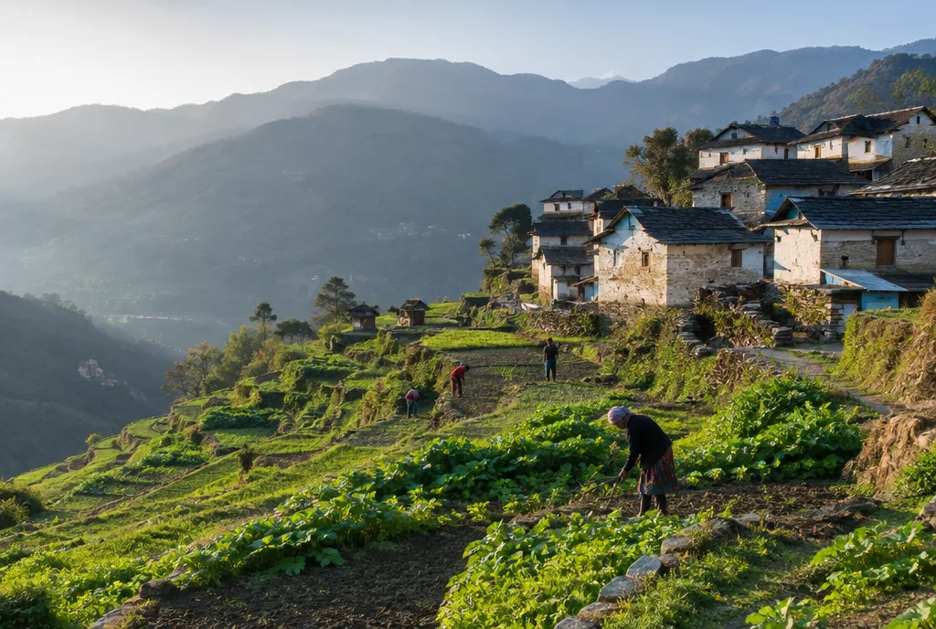
Consider an agricultural field. Physical geography can examine soils, climate, and landform. Human geography can examine the farming system, the cultural meaning of the land, its role in an economy, and the way it is organized within a wider landscape. Neither perspective makes the other unnecessary. Together, they show that places are both material environments and settings shaped by people.
This relationship also explains why modern human geography rejects environmental determinism. That nineteenth- and early-twentieth-century view held that the physical environment directly shapes human culture. Possibilism and mutual-interaction models offer a different account: environments matter, but human societies adapt to, interpret, and alter them. Human-environment interaction is reciprocal. Culture adapts to a place, and people change that place in return.
| Physical geography | Human geography |
|---|---|
| Studies landforms, climate, soils, and ecosystems | Studies activities, cultures, economies, and spatial interactions |
| Includes geomorphology, climatology, biogeography, hydrology, and pedology | Includes economic, cultural, political, population, and urban geography |
| Asks how natural features and systems work | Asks how human patterns are organized across space and connected to environments |
| Meets human geography in environmental and hazard research | Meets physical geography in human-environment interaction research |
Types of human geography: five foundations and practical specialties
The major divisions of human geography since 1945 are economic, social, cultural, political, and historical geography. Each puts a different part of human life at the center, but the divisions are connected. A political border can influence movement; a cultural practice can leave a mark on land; an economic route can alter the relationship between regions. The branches are lenses, not sealed compartments.
- Economic geography examines the spatial organization of economic activity, including trade flows and infrastructure.
- Social geography studies social relationships and communities in their spatial settings.
- Cultural geography explores how beliefs, practices, and identities are shaped by environments and how cultures transform the landscapes they inhabit.
- Political geography investigates power in space. Its subfields include electoral geography, geopolitics, strategic geography, and military geography.
- Historical geography brings the past into the explanation of present places and spatial arrangements.
Several widely taught specialties make those foundations more specific. Urban geography studies cities. Health geography, transport geography, and agricultural geography focus on patterns related to health, movement, and farming systems. Population geography studies the spatial distribution, composition, migration, and growth of populations by using demographic methods. Its central contribution is a spatial perspective on demography: not only how a population changes, but where the change occurs and how places are connected by it.
Population geographers work with concepts such as population density, birth and death rates, fertility rates, migration patterns, population pyramids, and the demographic transition model. The global population reached 8 billion in November 2022, after reaching 7 billion in 2011. Growth rates peaked at about 2.1 percent a year in the 1960s and had fallen below 1 percent by 2025. These are population facts, but their geographic meaning comes from asking how growth, composition, and movement vary across space.
The main topics: use geography to connect location, movement, and power
In K–12 curricula, five themes organize geographic thinking: location, place, region, movement, and human-environment interaction. They provide a compact way to move from observation to explanation. Location asks where something is. Place asks what makes a setting distinctive. Region groups areas with shared characteristics. Movement follows people, goods, or ideas. Human-environment interaction examines the two-way relationship between societies and their surroundings.
The AP Human Geography course develops these habits through seven official topics. It begins with thinking geographically, then addresses population and migration; cultural patterns; political organization; agriculture and land use; industrialization and development; and cities and urban land use. Together, these topics show why a geographic explanation often needs more than a map. It needs a way to connect a pattern to cultural processes, political control, economic systems, and environmental conditions.
- Start with pattern. Identify the distribution, boundary, route, or landscape that needs explanation.
- Choose the scale. A pattern can be considered in a neighborhood, a city, a state, or across countries; the useful explanation may change with scale.
- Connect people and place. Ask how culture, economy, politics, or population relates to the physical setting.
- Trace interaction. Look for movement, adaptation, exchange, control, or landscape change rather than treating a place as static.
These are not formulas for producing one predetermined answer. They are a way of making the spatial dimension visible. A movement question can lead to population geography; a boundary question can lead to political geography; a field or neighborhood can lead to cultural geography and human-environment interaction at the same time.
Human geography examples: read the marks people leave on place
Examples are most revealing when they link an observable pattern to a geographic question. Paris’s arrondissements, for instance, reflect historical central planning and social zoning. The point is not simply that Paris has administrative divisions. Their spatial layout offers a way to examine how planning and social organization become part of the city’s form.
Economic geography can follow infrastructure and trade. The China-led Belt and Road Initiative reshapes infrastructure and trade routes across more than 70 countries. That makes it a case for studying how routes connect places, how infrastructure changes spatial relationships, and how economic activity is organized beyond one national border.
Migration supplies another clear example. The United Nations reported 281 million international migrants worldwide in 2020, compared with 173 million in 2000. Migration geography examines such movement by looking at the connections between origin and destination and at the changing population patterns associated with those connections. Numbers establish the scale of a pattern; geography asks where it is concentrated and how it changes places.
Political geography studies territory and contested control. The Line of Control in Kashmir, on the India-Pakistan border, has been contested since 1947. A human geographer can treat it as more than a line on a map: it is evidence of how boundaries, claims, and control are organized in space.
Agricultural geography examines farming systems and land use. One contemporary example is vertical farming. The global vertical-farming market was valued at USD 5.6 billion in 2024 and was projected to reach USD 35.9 billion by 2032. This example directs attention to a changing farming system and to the economic and spatial arrangements around food production.
Cultural landscapes make human-environment interaction visible
A cultural landscape is the tangible and intangible expression of human culture as it interacts with and shapes the natural environment. It is one of the clearest bridges between cultural ecology and human geography because it records interaction in a place rather than treating culture and nature as separate subjects. A neighborhood, agricultural field, heritage site, religious landmark, or golf course can be read as part of a cultural landscape.
Carl Sauer introduced the term into human geography in his 1925 essay, “The Morphology of Landscape.” The Berkeley School of cultural geography, associated with Sauer from the 1920s through the 1960s, treated cultural landscapes as a visible record of human-ecology interaction. That approach gives a landscape an interpretive role: it is not just scenery, but a record of the relationships through which people have shaped an environment.
The National Park Service identifies four types of cultural landscapes: historic designed landscapes, vernacular landscapes, historic sites, and ethnographic landscapes. The categories distinguish intentionally designed settings, landscapes formed through everyday use, sites with historical importance, and places connected to the cultural practices of particular groups. UNESCO had inscribed 122 cultural landscapes worldwide by 2024, recognizing them as combined works of nature and people.
Cultural ecology asks a closely related question from within anthropology: how do human societies adapt to their environment? Human geography examines the same human-environment interaction through spatial patterns. Both fields ask how people shape environments and how environments shape human culture. Modern human geography extends the earlier discussion through political ecology, resilience science, and sustainability frameworks.
Three concepts that make the field more precise
Carrying capacity sets a question about limits
In human geography, carrying capacity is borrowed from ecology. It means the maximum population an environment can sustain indefinitely without permanently reducing its productivity. Ecological models denote carrying capacity with K, the equilibrium point where population growth stabilizes because resources impose constraints. The concept matters because it turns a general concern about population into a question about the relationship among people, resources, and environmental productivity.
Estimates of Earth’s human carrying capacity differ. A 2026 study calculated a sustainable capacity of roughly 2.5 billion people, while estimates based on food resources have put the maximum at 9 to 10 billion. The contrast is a reminder that carrying capacity is not a casual synonym for current population. It is a sustainability concept defined by what can continue without permanent loss of productive capacity.
Acculturation allows change without erasure
Acculturation is the process through which a culture adopts traits from another culture through sustained contact while retaining a distinct identity. Assimilation differs: it implies full absorption into a dominant culture. The distinction matters because cultural change does not automatically mean that a group becomes indistinguishable from another group.
Mexican immigrants in the United States provide a commonly used example. Second-generation individuals may adopt English and U.S. consumer habits while continuing to use Spanish-language media and maintain traditional cuisine. That selective adoption illustrates acculturation. It describes contact and change without requiring the disappearance of a cultural identity.
Territoriality explains why boundaries matter
Territoriality is the strategy of claiming, using, managing, or defending space. It involves creating boundaries and asserting control over a particular area, whether the actor is an individual, group, or state. Modern international states rest on territoriality: each has defined borders and territorial integrity. Robert Sack’s 1986 book Human Territoriality described territoriality as a spatial strategy for influencing behavior and controlling access.
Common mistakes: what human geography does not claim
Human geography is not simply physical geography with people added. Physical geography and human geography ask different questions, even when they study the same place. The former concentrates on natural features and systems; the latter centers human activities, cultures, and spatial interactions.
Environment is not destiny. Modern human geography rejects environmental determinism. Possibilism and mutual interaction better capture the idea that environments influence human choices while people also adapt to and transform their surroundings.
Acculturation is not assimilation. Acculturation permits selective adoption of traits while a group retains a distinct identity. Assimilation implies full absorption into the dominant culture. Confusing the terms removes an important distinction in how cultural contact works.
Carrying capacity is not a single uncomplicated population number. Its definition concerns the maximum population that can be sustained indefinitely without permanently reducing productivity. Competing estimates should not be treated as interchangeable with a present-day headcount.
Is AP Human Geography hard? Treat it as a course in spatial reasoning
AP Human Geography is a college-level introductory course first examined in 2001. It is often taken by ninth- and tenth-grade students, but it requires college-level reading, broad vocabulary, and analytical thinking. Its difficulty is moderate rather than trivial: in 2025, 64.7 percent of 283,512 test-takers earned a score of 3 or higher. The mean score was 3.14 out of 5; 17.0 percent earned a 5, while 9.9 percent earned a 1.
The exam rewards organized reasoning rather than memorizing isolated terms. It has 60 multiple-choice questions, worth 50 percent of the score, to be completed in one hour. Three free-response questions make up the other 50 percent and allow one hour and 15 minutes. A strong approach is to learn terms such as cultural landscape, territoriality, acculturation, population geography, and carrying capacity as tools for explaining a spatial pattern, not as definitions to recite without a place or example.
Frequently Asked Questions
What is the definition of human geography?
Human geography is the branch of geography that studies spatial relationships among human communities, cultures, economies, and their environments. It examines how human activity is organized across space and how it relates to the physical environment.
What are examples of human geography?
Examples include the planned and socially zoned layout of Paris’s arrondissements, international migration, trade and infrastructure routes associated with the Belt and Road Initiative, contested boundaries in Kashmir, and farming systems such as vertical farming.
What are the types of human geography?
Its five main divisions are economic, social, cultural, political, and historical geography. Widely taught specialties include urban, population, health, transport, and agricultural geography.
What are the main topics of human geography?
Core themes are location, place, region, movement, and human-environment interaction. AP Human Geography covers thinking geographically; population and migration; cultural patterns; political organization; agriculture and land use; industrialization and development; and cities and urban land use.
Is AP Human Geography hard?
AP Human Geography is considered moderately difficult. It is a college-level introductory course that demands reading, vocabulary, and analysis; in 2025, 64.7 percent of test-takers earned a 3 or higher.