A mountain ecosystem is a complex ecological community of living organisms thriving in montane areas, where climate, soils, and species composition shift dramatically with increasing elevation. Covering 24 percent of the Earth’s land surface, mountains compress broad regional climatic patterns into steep vertical gradients. From basal slopes and montane forests to cold alpine environments and permanent snowfields, mountain ecosystems host specialized plant and animal communities. This article explains how these environments work as habitats, water towers, and places where people live and farm.
What Defines a Mountain Ecosystem: Scale, Topography, and Global Extent
Mountains are spread unevenly across the continents. According to the United Nations Environment Programme (UNEP) classification, mountains account for 33 percent of Eurasia, 24 percent of North America, 19 percent of South America, and 14 percent of Africa. The longest continuous mountain range stretches uninterrupted along the western edge of the Americas from Alaska to Chile, while the largest and highest elevated mountain region on Earth is the vast Himalaya-Tibet Plateau.
UNEP sorts these landforms into seven mountain classes. The lowest category (Class 6) defines montane terrain as land with an elevation between 300 and 1,000 meters that exhibits an elevation difference of at least 300 meters within a horizontal distance of 7 kilometers.
Physically, an individual mountain landform is an abiotic geological factor defined by its rock substrate, relief, and elevation. However, a complete mountain ecosystem encompasses both abiotic components (such as temperature, precipitation, soil, and solar radiation) and living biotic components (such as plants, animals, and microorganisms). A primary physical driver is the drop in temperature with height: air temperature falls by an average of 0.65 degrees Celsius for every 100 meters of elevation gain.
This steady thermal decline, combined with shifts in precipitation and solar exposure, sets the physical boundaries for montane life. At the same time, biotic interactions such as competition, grazing, and mutualism modify and shift species boundaries across slopes alongside these physical environmental gradients. As a consequence, biological communities in montane environments reflect the combined influence of physical geography and ecological interactions.
Altitudinal Zonation: The Vertical Architecture of Highland Climate
The systematic distribution of distinct ecological communities along an elevational slope is known as altitudinal zonation. This ecological concept was first documented and described by naturalist Alexander von Humboldt, who systematically observed the steady decline of temperature with rising altitude. On a mountain slope, ascending a vertical gradient reflects environmental and climatic shifts that mirror traveling over vast latitudinal distances across lowlands.
In Rocky Mountain National Park, for example, the vegetation along a single mountain slope clearly displays these vertical transitions: the montane zone extends from 1,700 to 2,900 meters (5,600 to 9,500 feet), transitioning into the subalpine belt between 2,700 and 3,350 meters, before giving way to alpine tundra at and above 3,350 meters. The vegetation along a single mountain flank in this region reflects climatic transitions comparable to traveling overland from Denver, Colorado, to northern Alaska.
The elevational positioning of these biological belts is also governed by the Massenerhebung, or mass elevation effect. According to this phenomenon, extensive mountain massifs and high plateaus maintain higher treelines and elevated biological boundaries than isolated peaks of identical altitude. This occurs because large, massive mountain complexes retain heat more efficiently and provide greater shielding from prevailing winds than solitary, exposed mountains.
Animals also demonstrate clear altitudinal zonation patterns across mountain slopes. Biological taxa respond differently to vertical boundaries: invertebrate species tend to be more strictly confined to particular elevational zones, whereas vertebrate animals regularly move between different elevational belts on a seasonal basis in response to changing conditions and resources.
Ecologists usually describe five main zones. For the montane and alpine belts, the Holdridge Life Zone system gives biotemperature ranges:
| Elevational Zone | Characteristic Thermal Range | Dominant Environmental & Vegetative Features |
|---|---|---|
| Colline (Foothills) | Lowest, warmest belt | Basal slopes, foothills, and low-elevation valleys. |
| Montane Forest | Biotemperature of 6°C to 12°C | Mountain forest. |
| Subalpine | Between montane and alpine | Transitional belts characterized by stunted trees and Krummholz formations. |
| Alpine | Biotemperature of 1.5°C to 3°C | Treeless tundra dominated by grasses, sedges, herbs, mosses, lichens, and cushion plants. |
| Nival | Snow and ice | Barren rock, permanent snowfields, and glacial ice. |
The Treeline Transition: Ecological Thresholds of Tree Growth
The boundary between closed montane forest and open, high-altitude terrain is marked by the alpine treeline. Across the globe, the alpine treeline closely tracks the 6.4 to 6.7 degrees Celsius isotherm of mean air temperature during the growing season. For arborescent species to maintain growth, a growing season of at least 94 days with temperatures above 0.9 degrees Celsius is needed. Where seasonal conditions fail to meet these physiological thermal thresholds, tree growth stops.
Because thermal regimes correlate with global latitude and solar exposure, the elevation of the alpine treeline generally rises toward equatorial latitudes and decreases toward polar regions:
- Sajama Volcano (Bolivia): Supports the highest treeline on Earth at approximately 5,200 meters on its western slopes, formed by Polylepis tarapacana.
- New Guinea: Features high equatorial treelines reaching approximately 3,850 meters.
- Mount Kilimanjaro (Tanzania): Reaches an upper tree limit at roughly 3,100 meters.
- Canadian Rocky Mountains (51°N): Treeline occurs at approximately 2,400 meters.
- Swiss Alps (47°N): Upper forest boundaries stabilize at around 2,200 meters.
- Scotland (57°N): Treelines descend to approximately 500 meters.
In addition to air temperature regimes, snowpack exerts a dual effect on tree growth and survival at high altitudes. An excessive accumulation of snow that persists late into the year significantly shortens the growing season. Conversely, a moderate snowpack provides essential insulation that protects trees against extreme winter cold while maintaining soil water supply during warmer periods.
Life in the Alpine Tundra: Adaptive Strategies Above the Forest
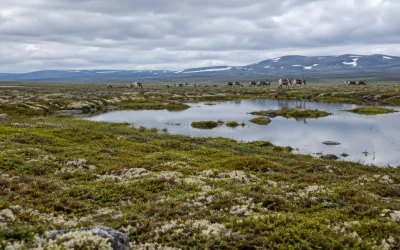
The alpine tundra begins above the climatic treeline and represents an open, treeless landscape characterized by a mean biotemperature between 1.5 and 3 degrees Celsius. This high-elevation zone is populated by specialized, low-growing vegetation consisting of perennial grasses, sedges, flowering herbs, ground-hugging cushion plants, mosses, and lichens.
Environmental conditions in the alpine tundra restrict soil formation, meaning that alpine soil is frequently thin and largely confined to sheltered rock crevices. In continental high-mountain ranges, underlying permafrost can occur beneath the surface.
Survival in this harsh environment requires morphological adaptations capable of enduring intense ultraviolet radiation, strong winds, and extreme cold temperatures. Cushion plants (polster plants) represent a quintessential adaptation to these parameters: growing in dense, compact structures close to the ground surface, they withstand abrasive winds, freezing temperatures, and high solar radiation. They grow very slowly, and some can live for more than 100 years.
Mountain Ecosystem Animals: Physiological and Behavioral Survival
Animal species inhabiting mountain ecosystems display specialized physiological and behavioral adaptations to steep relief, low temperatures, and high-altitude conditions. Because environmental conditions become progressively harsher with rising altitude, overall animal species richness and population abundance decline steadily above the montane zone. Nonetheless, specialized taxa thrive in these extreme high-elevation habitats.
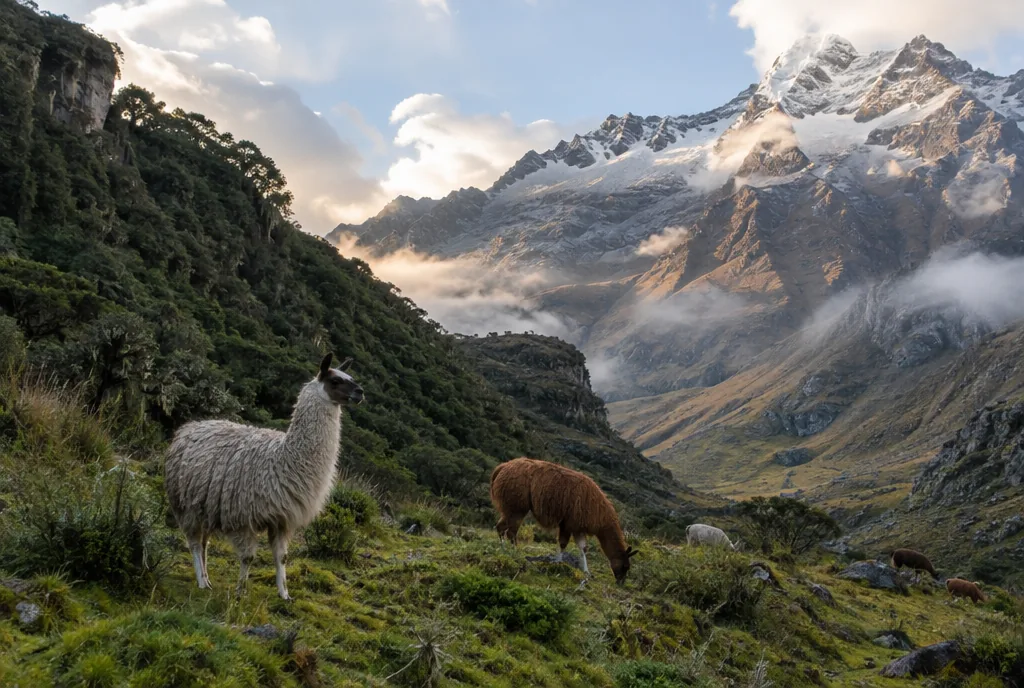
In the Himalayas and the mountain ranges of Central Asia, the snow leopard (Panthera uncia) lives permanently at elevations between 3,000 and 6,000 meters. Its wide paws function as natural snowshoes to distribute weight across snow, while its long tail provides vital balance along steep terrain. In the European Alps, the alpine ibex (Capra ibex) scales near-vertical rock faces. Across the high Andean plateau at elevations above 4,000 meters, the vicuña (Lama vicugna) is a wild South American camelid that produces the finest wool found among all camelids. Thousands of years ago, pre-Columbian cultures domesticated alpacas and llamas, which continue to form the primary foundation of livelihood for Andean highland populations today.
Avian and mammalian species at high elevations employ distinct behavioral and physiological survival strategies:
- Seasonal Camouflage: Both the mountain hare (Lepus timidus) and the rock ptarmigan (Lagopus muta) undergo seasonal transformations, molting their brown summer pelage and plumage to white in winter as protective camouflage against snowy backgrounds.
- Soaring Flight: The Andean condor (Vultur gryphus), possessing a wingspan reaching up to 3.2 meters, inhabits the Andes and utilizes thermal updrafts along steep mountain slopes for efficient soaring flight.
- Species Reintroduction: In the European Alps, targeted wildlife conservation programs have successfully reintroduced key species, including the lynx, the brown bear, and the bearded vulture (lammergeier).
Global Biodiversity Hotspots and Mountain Forest Formations
Mountain ecosystems represent some of the most significant global centers of vascular plant diversity. The highest concentrations of vascular plant species on Earth are situated in montane regions, specifically within the tropical Eastern Andes, Costa Rica, the Atlantic coastal forest of Brazil, the eastern Himalaya-Yunnan region, and northern Borneo. The Himalayan range alone contains 13 of the world’s 825 distinct terrestrial ecoregions. Across the Himalayas, studies found that the highest levels of biodiversity do not occur at the low base or the high peaks, but rather in intermediate elevational belts between 1,000 and 3,000 meters.
A similar vertical pattern is documented along the Volcán Barva elevational transect in Costa Rica, where tree species richness reaches its maximum just above the lowest elevations before declining steeply toward high-altitude cloud forests. Globally, tropical and subtropical mountain forests encompass an estimated 305 million hectares, representing approximately 13 percent of the planet’s total tropical and subtropical forest area.
Within these highland zones, tropical montane cloud forests (TMCF) cover only 2.5 percent of the world’s total tropical forest area, yet they harbor a disproportionate concentration of endemic species. In Costa Rica’s Monteverde Cloud Forest, persistent cloud cover supports more than 500 distinct orchid species. Cloud forests typically occur within an elevational band spanning 500 meters in width, situated between 500 and 4,000 meters in altitude depending on proximity to the ocean. In southwest China, the Hengduan Mountains on the margins of the Tibetan Plateau represent the oldest continuous alpine ecosystem in the world, where roughly 3,000 plant species have coexisted for up to 30 million years.
Earth’s Water Towers: Hydrological Lifelines for Downstream Regions
Mountains act as ecological water towers for the planet, supplying essential freshwater that sustains at least half of the global human population for household needs, agricultural irrigation, industrial processes, and hydroelectric power generation. In arid and semi-arid regions, more than 90 percent of all river runoff originates directly from mountain catchments.
In Europe, the Alps occupy only 11 percent of the total Rhine River catchment area, yet they generate 31 percent of its total annual discharge. During dry summer periods, the proportion of Rhine discharge supplied by the Alps increases to more than 50 percent.
In tropical mountains, cloud forests capture additional atmospheric moisture through fog condensation on their vegetative canopies. Measured values of fog condensation range from 0.15 millimeters per day in montane Mexico to 3.3 millimeters per day in the cloud forests of Hawaii. At a broader scale, the Himalayas are designated as the “Third Pole” because they contain the headwaters of Asia’s largest river systems, upon which more than two billion people directly depend for their water supply.
Cultural Ecology: Vertical Integration, Terracing, and Highland Livelihoods
Approximately 12 percent of the world’s population, roughly 900 million people, resides directly within mountain regions. Human populations have inhabited and managed montane environments for thousands of years. As early as the beginning of the third millennium BCE, mountain farming and pastoral communities developed irrigation and terrace systems while domesticating high-altitude livestock, including yaks, llamas, mountain goats, and sheep, alongside staple agricultural crops such as barley, wheat, maize, and potatoes.
Highland human communities adapted to complex vertical environments through specialized traditional land-use techniques:
- Vertical Integration: In the Andes, local communities cultivate distinct crops across different elevational tiers as a deliberate strategy of vertical integration.
- Terrace Agriculture: Terraced farming is the most widespread traditional technique used to enable agriculture on steep montane slopes, effectively protecting soils against erosion while conserving and storing essential water reserves.
- Transhumance: The seasonal movement of livestock between lowland winter areas and high summer pastures, known as transhumance, is the traditional land-use system practiced across the Alps, the Carpathians, the Caucasus, the Atlas Mountains, and Central Asia. In Switzerland, high-altitude summer pastures account for one-third of all agricultural land.
- Religious Importance: Mountain landscapes frequently serve as focal points for religious practices and pilgrimage. Every year, 9.3 million pilgrims travel to Hardwar-Rishikesh, the geographic gateway to the Garhwal Himalayas, illustrating the profound religious utilization of mountain regions.
Contemporary human expansion continues to alter mountain environments. In Asia, 23 percent of new human activity has taken place in highland regions, divided between hilly land (45 percent) and steep mountains (55 percent). Furthermore, 76 percent of these converted areas were established on land formerly classified as ecological land.
Climate Vulnerability and Ecological Disruption
Mountain regions are warming faster than the global average. In the Himalayas, rising temperatures have caused the start of the vegetative growing season (SOS) to shift earlier by an average of 1.53 days per decade. Concurrently, rising temperatures push the cloud base in tropical cloud forests to higher altitudes, progressively compressing and reducing the total area of suitable habitat available to specialized montane species.
In the Andes, montane cloud forests are threatened by the combined impacts of climate warming and regional deforestation, which disrupts the natural upslope transport of atmospheric moisture. In addition to atmospheric warming, mountain environments are highly susceptible to changes in land use. In the French Pyrenees, the widespread abandonment of traditional agriculture has triggered major ecological changes across entire elevational belts.
Despite these vulnerabilities, certain montane forest ecosystems display notable resilience to moisture deficits. In a five-year rainfall exclusion experiment conducted within a Peruvian cloud forest, forest trees maintained their function as a carbon sink even when soil moisture was experimentally reduced by 69 percent, demonstrating an unexpectedly high degree of ecological resilience.
Common Myths and Misconceptions About Mountain Ecosystems
Several common ideas about mountains do not match the data:
- Misconception 1: Mountains are purely abiotic rock structures. While a mountain landform itself (rock, relief, and elevation) is an abiotic factor, a functioning mountain ecosystem comprises continuous interactions between abiotic components (temperature, precipitation, soil, and solar radiation) and living biotic components (plants, animals, and microorganisms).
- Misconception 2: Species biodiversity steadily declines from the base of a mountain to its summit. Biological diversity does not decrease in a linear fashion with increasing elevation. In major mountain regions like the Himalayas, the highest overall biodiversity occurs in intermediate elevational zones between 1,000 and 3,000 meters rather than at the basal lowlands or the highest peaks. Similarly, transects like Volcán Barva in Costa Rica show tree richness peaking just above the lowest elevations before declining toward cloud forests.
- Misconception 3: The alpine treeline occurs at the same elevation worldwide. The global treeline is not defined by a fixed altitude, but rather by physiological thermal thresholds: specifically, the 6.4 to 6.7 degrees Celsius isotherm of mean growing season air temperature and a minimum growing season of 94 days with temperatures above 0.9 degrees Celsius. Consequently, treelines reach roughly 5,200 meters on the western slopes of Sajama Volcano in Bolivia, approximately 3,850 meters in New Guinea, 3,100 meters on Mount Kilimanjaro, 2,400 meters in the Canadian Rockies, 2,200 meters in the Swiss Alps, and descend to about 500 meters in Scotland.
- Misconception 4: High alpine plants are delicate and short-lived. Above the treeline, alpine tundra vegetation consists of slow-growing perennial grasses, sedges, herbs, mosses, lichens, and cushion plants adapted to severe cold, wind, and intense ultraviolet radiation. Some cushion plants can live for more than 100 years.
Frequently Asked Questions
What is a mountain ecosystem?
A mountain ecosystem is a complex ecological community of living organisms thriving in montane areas, where climate, soils, and species composition shift dramatically with altitude. Covering 24 percent of the Earth’s land surface across seven UNEP mountain classes, mountain ecosystems comprise both abiotic physical foundations and diverse biotic communities distributed across distinct vertical zones.
What animals live in a mountain ecosystem?
Mountain ecosystems support specialized animals adapted to high-altitude terrain and harsh climates. Notable species include the snow leopard (Panthera uncia), which lives year-round between 3,000 and 6,000 meters in the Himalayas and Central Asia; the alpine ibex (Capra ibex) in the European Alps; and the wild vicuña (Lam vicugna) in the Andes above 4,000 meters. Other fauna include domesticated camelids like llamas and alpacas, herbivores and birds that turn white in winter such as the mountain hare and rock ptarmigan, soaring raptors like the Andean condor, and reintroduced European species including lynx, brown bear, and bearded vulture.
Are mountains biotic or abiotic?
A mountain landform as a physical geological entity is an abiotic factor characterized by rock, relief, and elevation. However, a complete mountain ecosystem contains both abiotic components (such as temperature, precipitation, soil, and solar radiation) and living biotic components (such as plants, animals, and microorganisms) that continually interact across vertical gradients.
What are the main types of ecosystems found on mountains?
Mountain environments are divided into five primary elevational zones along the altitudinal gradient: the colline zone (foothills and basal slopes), the montane zone (mountain forests, including tropical montane cloud forests), the subalpine zone (transitional belts characterized by Krummholz formations), the alpine zone (treeless tundra dominated by grasses, sedges, herbs, mosses, lichens, and cushion plants), and the nival zone (permanent snow, ice, and bare rock).
Why are mountain ecosystems referred to as water towers?
Mountains are designated as Earth’s water towers because they supply freshwater for at least half of the global human population for household, irrigation, industrial, and hydroelectric use. In arid and semi-arid regions, over 90 percent of river runoff comes from mountains. Major massifs like the Alps provide substantial runoff to continental river systems such as the Rhine, while the Himalayas, known as the “Third Pole”, hold the headwaters of Asia’s largest river systems upon which over two billion people rely.